The seafloor changes. Knowing how and how fast matters
Traditional survey methods are expensive, infrequent, and hard to compare over time. Periodic ROV dives and manual video analysis can't keep pace with ecosystems that change continuously.
MarineSitu replaces episodic surveys with continuous quantitative monitoring: species coverage, substrate change, and 3D habitat structure, accumulating automatically over months and years.
Quantitative change over time
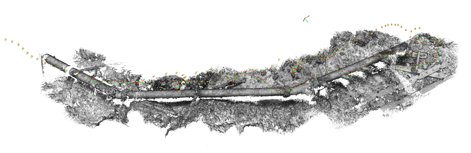
3D depth and size estimation
The C3 stereo camera produces calibrated depth maps, enabling accurate species sizing, substrate height measurements, and volumetric change detection over time.
Automated species and substrate classification
Machine learning models classify benthic organisms and substrate types from imagery, quantifying coverage area, density, and change between monitoring periods.
Repeatable monitoring
MarineSitu hardware is designed to last, giving you consistent, repeatable views of the same habitat over time.
Data analysis tools
SaltySuite's benthic analysis tools and automated processing pipelines turn survey imagery into structured, quantitative outputs, dramatically reducing review effort.
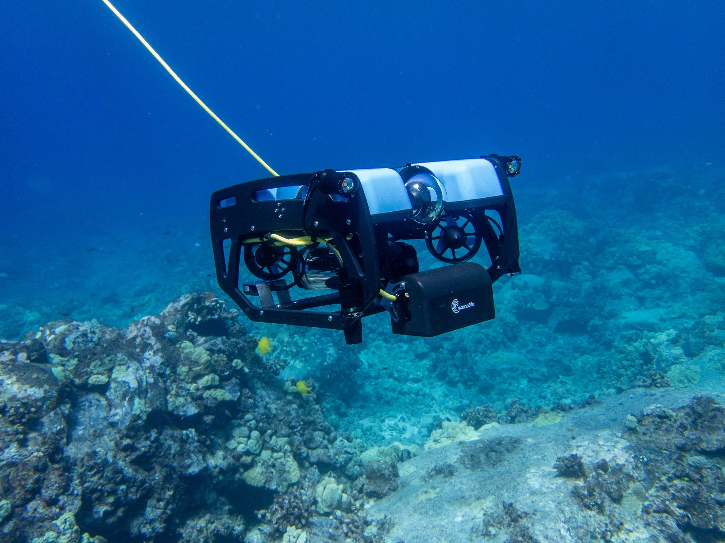
Mobile ROV integration
MarineSitu hardware integrates with ROVs and AUVs for survey-mode mapping, combining high-resolution imagery with onboard depth and position data.
Infrastructure inspection and monitoring
Track biofouling accumulation, structural change, and biological encrustation on subsea cables, pipelines, foundations, and mooring systems over time.
Who benefits
Benthic mapping with MarineSitu serves research institutions, environmental monitoring programs, infrastructure operators, and regulatory agencies who need quantitative, repeatable data on what's happening on the seafloor, over time, not just at a single survey moment.
Habitat monitoring programs: track species composition, coverage change, and biodiversity indicators across habitat types such as kelp beds, coral, and rocky reef. Long-term datasets reveal trends that no single survey can detect.
Marine energy and offshore infrastructure: quantify biological colonization on foundations, cables, and mooring systems. Track structural change and identify inspection priorities without costly ROV mobilizations.
Environmental impact assessment: establish a quantitative pre-construction baseline and monitor for change throughout project lifecycles. Automated analysis makes ongoing monitoring cost-effective at the spatial and temporal scales regulators require.
Aquaculture site assessment: evaluate substrate quality, current patterns, and biological productivity for site selection and ongoing farm health monitoring.
Map your seafloor
From fixed-station long-term monitoring to mobile survey campaigns, MarineSitu can design a benthic mapping system for your habitat type, depth, and data requirements. Contact us to discuss your project.
Book a demo →